
Understanding Isochrones and Isodistances
In the realm of urban planning, market analysis, and transportation logistics, the concept of catchment areas plays a pivotal role in location intelligence. In retail, a catchment area refers to the geographic region from which a store or business draws its customers. It is the area surrounding a retail location where the majority of its patrons live, work, or pass through. Understanding the catchment area helps retailers identify their target market, optimize location strategy, and tailor marketing efforts to attract and retain customers within that specific zone.
A catchment area, often depicted through isochrones and isodistances, delineates the geographic extent of influence for a particular point of interest, such as a school, store, or transportation hub. Understanding these concepts is crucial for businesses, city planners, and anyone interested in optimizing spatial strategies. Catchment Area analysis may be complemented with temporal understanding for maximum efficiency.
Isochrones and isodistances are graphical representations of catchment areas based on time and distance, respectively.
Time
Isochrones are lines on a map that connect points that can be reached within the same amount of time from a specific location. For example, if you draw a 15-minute isochrone around a school, it represents all the areas that can be reached within a 15-minute walk, drive, or public transport ride from that school.

15 minutes walking increments isochrone

15 minutes increments walking isochrone

15 minutes increment driving isochrone

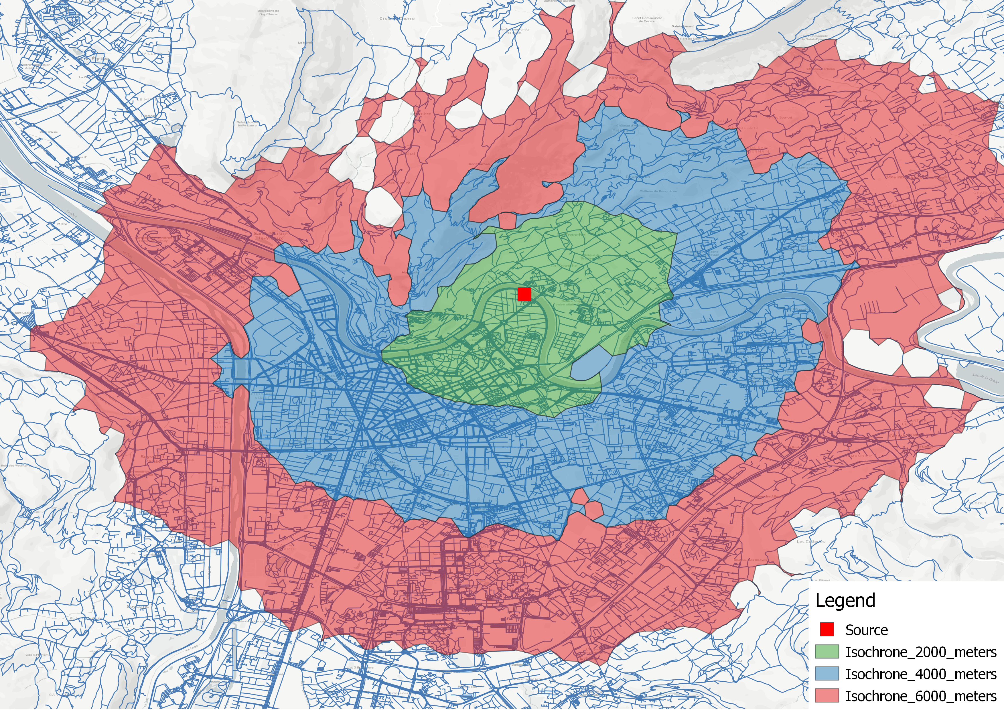
10km increment cycling isodistance
Distance
Isodistances, on the other hand, are lines that connect points at an equal distance from a given location. These lines depict areas that are equidistant from the origin point, regardless of the time it takes to travel those distances. For instance, if you draw a 5-mile isodistance around a store, it represents all the areas that are exactly 5 miles away from that store.
For retailers, understanding catchment areas is vital for site selection and understanding customer demographics. By analyzing isochrones, businesses can gauge the accessibility of potential store locations to their target market within a certain travel time. This helps in choosing locations that maximize foot traffic and sales potential.
Transportation PlanningTransport authorities use catchment areas to plan public transport routes and schedules. By mapping isochrones around transportation hubs, they can assess the accessibility of different areas and optimize routes to serve the largest population effectively.
Real EstateIn real estate, catchment areas influence property values. Proximity to desirable locations like schools, parks, or public transport nodes often increases property prices. Isochrones help real estate agents and buyers understand the reach of these amenities from a particular property.
Healthcare ServiceHospitals and clinics use catchment areas to ensure that their services are accessible to the population they serve. By analyzing isochrones, healthcare providers can identify underserved areas and plan for the distribution of services more effectively.
In retail, understanding the catchment area is crucial for optimizingstore locations and marketing strategies. This area can be divided into primary, secondary, and tertiary zones based on the concept of isochrones, which are lines on a map that connect points equidistant in travel time from a specific location.
By understanding these catchment zones, retailers can tailor their services, inventory, and marketing efforts to cater to the specific needs and behaviors of customers based on their proximity and likelihood to visit the store.
For the primary zone, retailers can focus on convenience, local marketing, and optimizing in-store experiences to foster loyalty and repeat visits. Inventory levels and product assortments can be fine-tuned to meet the immediate needs of the local community.
In the secondary zone, retailers may emphasize unique offerings, competitive pricing, or specialized services to attract and retain customers who have a wider range of options available to them. Marketing efforts can be tailored to highlight the store's differentiating factors and build brand awareness within this broader catchment area.
For the tertiary zone, retailers can leverage targeted promotions, special events, or exclusive product lines to entice customers to make the longer journey. Strategic partnerships with complementary businesses or leveraging online channels can also help extend the store's reach and appeal to this outer catchment area.
By leveraging catchment area analysis, retailers can make informed decisions about store locations, inventory management, and marketing strategies, ultimately enhancing customer experiences and driving long-term success in a competitive retail landscape.While catchment areas provide valuable insights, their accuracy depends on various factors such as transportation modes, traffic conditions, and terrain. Additionally, demographic factors like population density and socioeconomic status can influence accessibility. Therefore, it's essential to consider these factors while interpreting catchment area analyses.
Catchment areas, represented through isochrones and isodistances, are powerful tools for understanding spatial relationships and accessibility.
From retail planning to urban development, these concepts play a crucial role in decision-making processes. By leveraging catchment area analyses, businesses, city planners, and organizations can optimize resource allocation, improve decision-making, and enhance the overall quality of life for communities.
Understanding the intricacies of catchment areas is key to building more efficient, accessible, and sustainable cities for the future.